Moab, Utah and Arches National Monument

Date: July 22, 2002
Current location:  Moab, UT


The drive into Utah was gorgeous.  We went through Durango, Colorado and saw some fantastic scenery.  

The hotel in Moab we stopped at was being used by firemen as a headquarters for the operation to contain the wildfires in the area.  And it looked like a pretty big area... lots of firemen.  I peeked into the meeting room and saw people looking at aerial photographs through magnifiying lenses.  From the sound of the conversation, they were making good progress.

Oh, another thing about the hotel:  there were bats zooming around the lights in the parking lot at night.  I love bats.

We got up just after dawn and drove up to Slick Rock trail by about 6:30am.  They recommend starting by 7am.  We actually looked like we knew what we were doing at this point.

A tour of mountain bikers from foreign lands (maybe New Zealand) was getting started just ahead of us.  One of the women on the tour got to the first steep bit of the practice loop and decided not to ride.  We were intimidated too, but we decided to walk the bikes forward in hopes of easier trails.  It turned out to be scary, but we could ride most of it.

Slick Rock checklist

Length of trail we covered
2.7 miles
Top speed
22 mph
Average speed (when not walking)
7 mph
High temperature on the day we biked
107° F


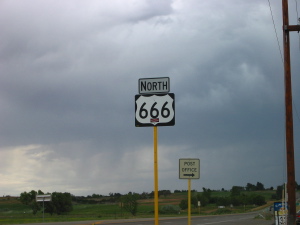
On the way to Moab, we drove this stretch of road.  I could swear I saw a bright red Dodge pickup heading south.  Hmmmm.
highway from hell
Here Julie is looking less than pleased about the Slick Rock trail so far.  If you look carefully, you can see the dashed white lines that mark the trail on the orange rock.  On very tight corners, the white dashes would have cross-hatch marks that made a symbol very much like a scar with stitches.  Hmmmm.
sick rock trail
Here I am at another stop with the trail heading off into the background.  From all the pictures, you'd think we stopped an awful lot.  We did.  I just didn't trust the guy with the white paint.  That white line did some really crazy things.
ryan at slick rock
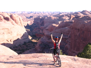
Here Julie is trying out for a Powerbar commercial.  Actually, this is a stop that overlooks a gorge that the New Zealand guide said was the site for filming part of Star Wars.  Does it look like someplace that R2-D2 and C3-PO might have been?
Powerbar commercial
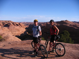
The nice New Zealand guide took our picture too.
both of us at slick rock
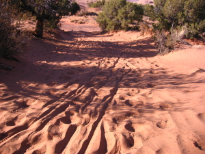
Then there was the site of my endo into the sand.  The trail drops a few feet from rock into this sand.  I came down without lifting my front wheel and it just buried itself and I flew over the handlebars.  It was the only crash and it was pretty soft sand.  It was the most comical part of the day.
soft sand
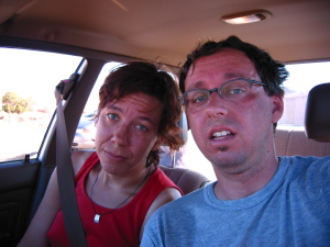
This is what we looked like after about two hours and 2.7 miles, but before we jumped in the pool at the hotel.
our butts are kicked

Then we drove through Arches National Monument which turns out to be right next to Moab.  This is where it started to get hot, but still not as hot as Texas.

These photos really give no sense of scale, and the thing that the park really offers is a grand sense of scale.  Both scale measured in thousands of feet and in millions of years.  So these may be kind of pretty, but there is a shocking amount of information that is missing.
arches
This is something like the biking trail that we were just on.
arches
We zipped through the park and only got out this once to go to a bathroom, and still it took us two hours to drive through it.
traveling bikes
The formations had something to do with salt deposits.  That's about all I remember.
arches


How to contact us:
    rfd@finninday.net
    jfd@finninday.net